Undergraduate Research
Motion Planner To Explore Unknown Rough Terrain

Introduction
Tech Stack: Robot Operating System (ROS), Octomap Library, Turtlebot system
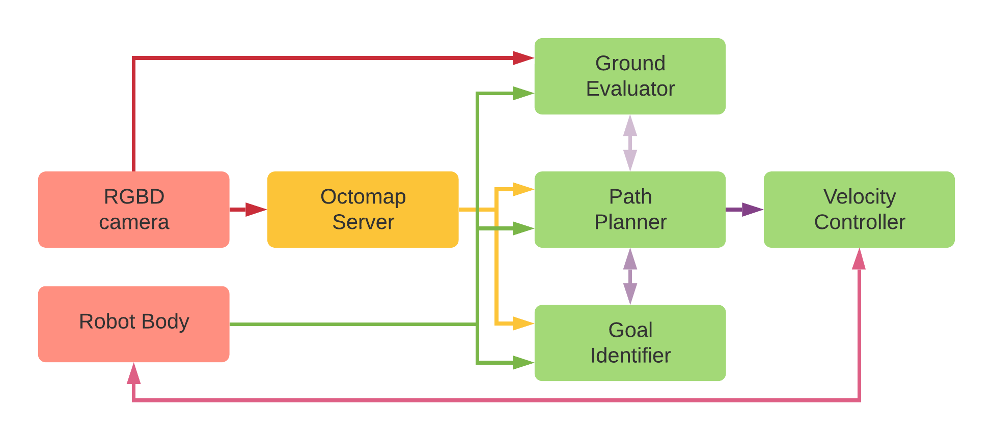
The research project “Motion planner to explore unknown rough terrain” is focused on building a motion planner for wheeled robot systems to explore unknown terrains. The system contains 4 components,
- Goal Identifier
- Path Planner
- Velocity Controller
- Ground Evaluator
Goal Identifier
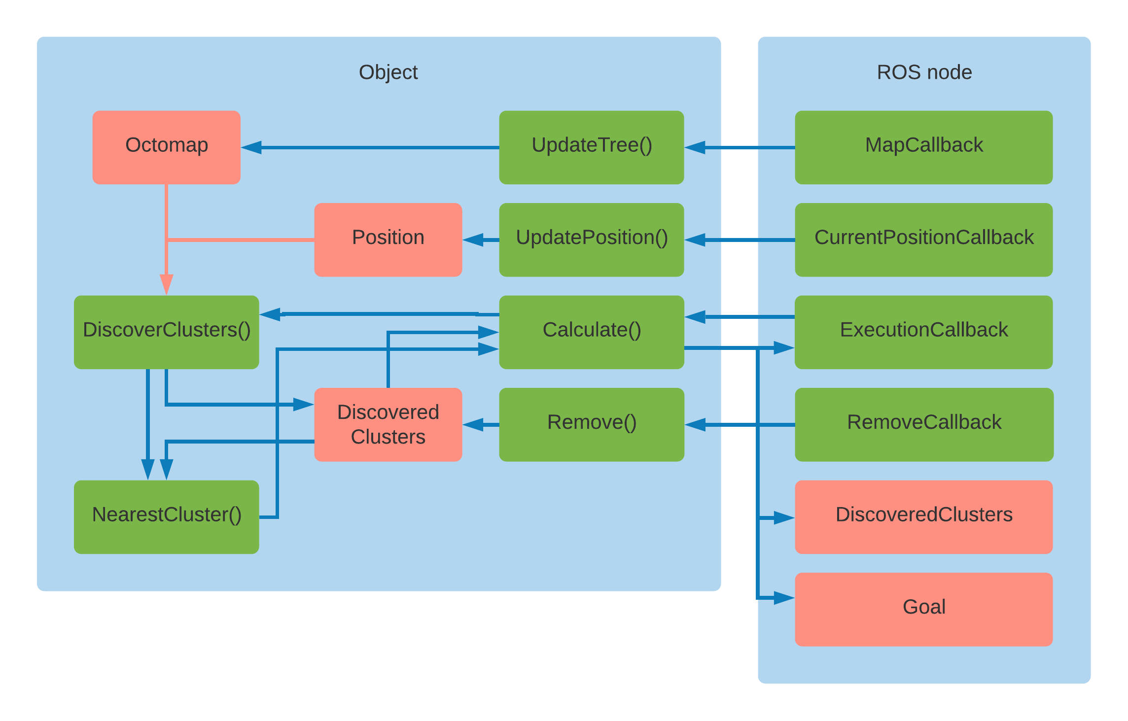
The Goal Identifier subsystem analyses the voxel map of the environment by clustering it into groups. Each group is evaluated to identify the occupied voxel percentage. If it is above a pre-defined threshold, it is considered an unexplored cluster. Once all the clusters are identified, the closest cluster to the robot position is selected as the exploration target. The following image contains the design of this subsystem.

Path Planner
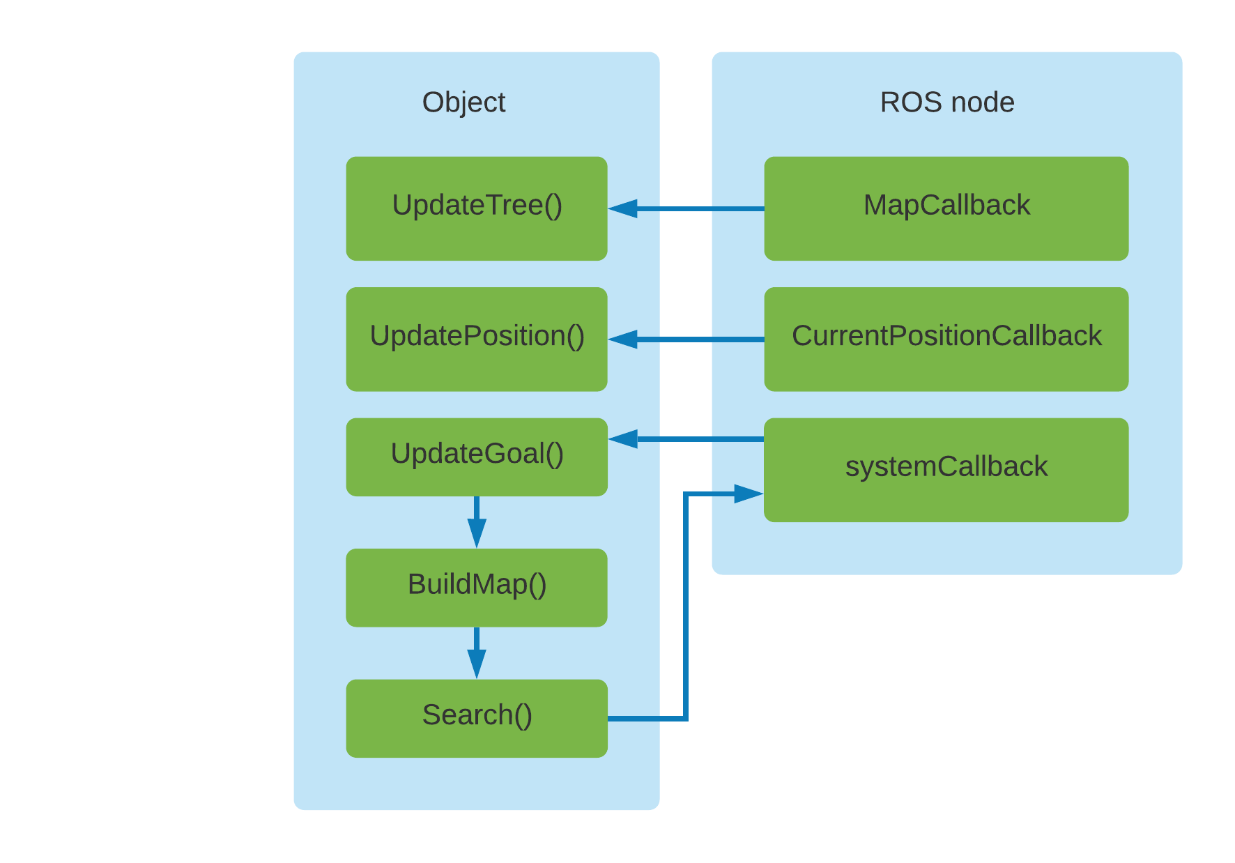
The path planner calculates a 2D map of the environment by down projecting the 3D voxel map of the environment. Then it uses the robot’s position, goal position calculated by the Goal Identifier subsystem, and calculated 2D map to calculate a path. The following image explains the design of this subsystem.

Velocity Controller
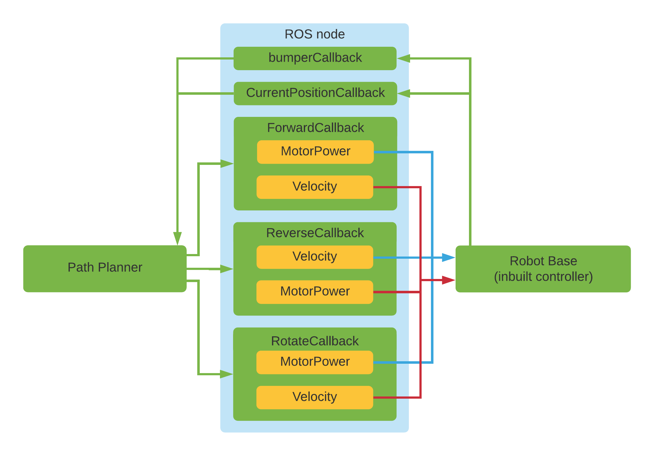
This sub-system controls the robot as requested by the Path Planner Sub system. Supports 3 basic movements, Forward, Backward, and Rotation. The following image shows the design of this sub-system.

Ground Evaluator
This subsystem uses camera images to identify water puddles in the ground. Was not integrated into the final system.